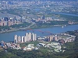
Bali District
Bali
八里區 | |
|---|---|
| Bali District | |
 Cityscape of Bali | |
 Bali District in New Taipei City | |
| Coordinates: 25°9′N 121°24′E / 25.150°N 121.400°E | |
| Country | Republic of China (Taiwan) |
| City | New Taipei City |
| Area | |
| • Total | 15.25 sq mi (39.49 km2) |
| Population (February 2023) | |
| • Total | 41,032 |
| Time zone | UTC+8 |
| Website | www |
Bali District (Chinese: 八里區; pinyin: Bālǐ Qū; Pe̍h-ōe-jī: Pat-lí-khu) is a suburban district in northwestern New Taipei, Taiwan. In Taiwanese Hokkien, it was known as Pat-lí-hun (八里坌) during the rule of the Qing dynasty.[1][2]
History
[edit]

Based on examinations of grave goods it is believed that the ancient settlement of Shihsanhang was one of the wealthiest in Taiwan, it was only one of two communities in prehistoric Taiwan to master iron smelting. The ironware they produced was traded throughout Taiwan.[3]
During the period of Japanese rule, Bali was called Hachiri village (八里庄), and was governed under Tamsui District of Taihoku Prefecture. After the handover of Taiwan from Japan to the Republic of China in 1945, Bali became a rural township of Taipei County. On 25 December 2010, it became a district of New Taipei City.
Administrative divisions
[edit]
Bali District administers ten urban villages:[4][5]
- Longyuan (龍源里), Micang (米倉里), Dakan (大崁里), Pitou/Beitou[citation needed] (埤頭里), Dinggu (頂罟里), Jiucheng (舊城里), Xuntang (訊塘里), Laoqian/Peiqian[citation needed] (荖阡里), Changkeng/Zhangkeng[citation needed] (長坑里) and Xiagu (下罟里).
Education
[edit]Bali district has one high school, one municipal middle school, and five elementary schools, including the New Taipei Municipal DaKan Elementary School.

Tourist attractions
[edit]- Shihsanhang Museum of Archaeology
- Sustainable Development Education Center
- Wazihwei Nature Reserve
- Bali Old Street
- Bali Left Bank Park
- Bali Sailing Pier
- Shisanhang Cultural Park
- New Taipei City Archeology Park
- Bali Shanggang Park (八里商港公園)
- Danjiang Bridge Vision Pavilion
Transportation
[edit]- Port of Taipei
- Provincial Highways 15, 61 and 64, and City Route 105
- Bali Ferryboat Wharf
- Bali light rail (Expected to open in 2024 at the earliest)
References
[edit]- ^ "Bali travel guide of hot destinations(旅遊王TravelKing)–Taiwan travel hotels,New Taipei City tourism,Bali". Travelking.com.tw. Retrieved 2014-05-25.
- ^ 臺灣歷史地圖 增訂版 [Taiwan Historical Maps, Expanded and Revised Edition] (in Chinese (Taiwan)). Taipei: National Museum of Taiwan History. February 2018. p. 120. ISBN 978-986-05-5274-4.
臺北廳行政區域圖 1909年{...}滬尾支廳 小八里坌區
- ^ Caltonhill, Mark. "'The dead don't bury themselves'". www.taipeitimes.com. Taipei Times. Retrieved 18 August 2020.
- ^ 行政區域. Bali District Office New Taipei City (in Chinese (Taiwan)). 24 June 2017. Archived from the original on 10 August 2020. Retrieved 30 June 2019.
八里區的行政區隸屬於新北市,為新北市廿九個區之一,全區又可分為十個里,分別為埤頭、頂罟、舊城、訊塘、荖阡、下罟、長坑、龍源、米倉及大崁,
- ^ "2018 Local Elections". Central Election Commission. Archived from the original on 30 June 2019. Retrieved 30 June 2019.
Longyuan Vil. Micang Vil. Dakan Vil. Beitou Vil. Dinggu Vil. Jiucheng Vil. Xuntang Vil. Peiqian Vil. Zhangkeng Vil. Xiagu Vil.
, Chinese version: [1]
External links
[edit] Bali District travel guide from Wikivoyage
