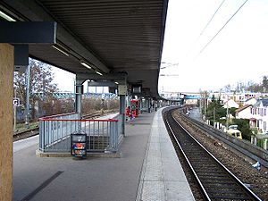
Conflans-Fin-d'Oise station
Appearance
(Redirected from Conflans – Fin d'Oise (SNCF))
This article needs additional citations for verification. (May 2019) |
Conflans-Fin-d'Oise | ||||||||||||||||||||||||||
|---|---|---|---|---|---|---|---|---|---|---|---|---|---|---|---|---|---|---|---|---|---|---|---|---|---|---|
 | ||||||||||||||||||||||||||
| General information | ||||||||||||||||||||||||||
| Location | Rue d'Andrésy 78700 Conflans-Sainte-Honorine France | |||||||||||||||||||||||||
| Owned by | SNCF | |||||||||||||||||||||||||
| Managed by | SNCF | |||||||||||||||||||||||||
| Platforms | 1 central (RER) 2 latéraux (Transilien) | |||||||||||||||||||||||||
| Other information | ||||||||||||||||||||||||||
| Fare zone | Zone 5 | |||||||||||||||||||||||||
| Services | ||||||||||||||||||||||||||
| ||||||||||||||||||||||||||
Conflans–Fin d'Oise is a railway station serving Conflans-Sainte-Honorine. It is a two-level station situated on the lines from Saint-Lazare to Cergy-le-Haut and from Saint-Lazare to Mantes-la-Jolie via Conflans-Sainte-Honorine.
The lower station (RER A and Transilien L) of Conflans-Fin-d'Oise welcomed nearly 9,500 passengers per day in 2009.[1] In 2012, 1860 passengers took the train to the train station (Transilien J) every week.[2]
Photo gallery
[edit]-
Station Conflans-Fin-d'Oise.
-
Accessibility works at Conflans-Fin-d'Oise station.
-
Bridges over the Oise, road in the foreground, and railway, in the background, the latter on the Paris - Mantes line by Conflans.
-
The railway bridge of the Achères - Pontoise line, used by RER A trains.
See also
[edit]Wikimedia Commons has media related to Gare de Conflans-Fin-d'Oise.
References
[edit]- ^ Comité de ligne du RER A Archived 2013-10-29 at the Wayback Machine
- ^
"Délibération n° 2012/301, séance du 10 octobre 2012" (PDF). le site du STIF. p. 15. Retrieved 25 August 2013.
Déploiement de nouveaux afficheurs Infogare TFT/TLED lignes L&J, Volet information voyageurs : Identifiant PQI 181
. Le STIF définit le nombre de montants pour une gare comme le nombre de voyageurs y prenant le train les jours ouvrés et hors période de vacances scolaires.
External links
[edit]- Conflans-Fin-d'Oise station at Transilien, the official website of SNCF (in French)
48°59′28″N 2°04′26″E / 48.991°N 2.074°E


